Only one way to find out...
Osoj mountain, also known as Rasa, is the highest peak on Skopje's south side, culminating at 1354m, as I personally checked with my GPS, slightly less then advertised. I had to wait until yesterday to go up there because there was too much snow at the summit, but with the warm weather we started having lately, it virtually disappeared overnight.
I hopped on the good ol' number 60 bus from Deksion and got off next to the Sv. Bogorodica church, then took the same trail leading to Sv. Spas, except that instead of turning left at one point, I continued straight on until I reached the village of Gorna Matka.
Now, the bus usually goes to Gorna Matka, but on this day, it didn't, I don't know why. Never mind, the extra couple of kilometres got me warmed up for the rest of the hike, and I met some nice people in the village, including the dude with his donkey that I often meet in the winter collecting wood. We had a nice chat, and he told me that the old dude next to him had been up there a long time ago, for what I do not know, and confirmed that it was a GOOD walk up. Had them laughing. Why would anyone want to go up there for fun? What's the matter with me, I'm sick or something ?
No, I answered, I'm going up because it's there..........
My plan was to take the mountain road that goes from Gorna Matka up to the Jasen reserve forest park, at about 1000m elevation. Then, to figure out a route to the summit from there. As far as I could make out, that was the only way of doing it.
 |
| The mountain road, just after Gorna matka. |
 |
| The road goes through a plain for a while, it is a pleasant and easy hike to the top. |
 |
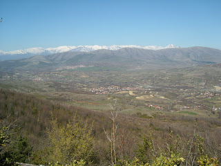
| The view starts to become interesting as you go up. |
 |
| The Sar mountains in the background. |
 |
| A view east, you can see the Millenium Cross on Vodno in the background, and Sv. Nedela in the middle of the picture. Skopje is on the left. |
The walk up is nice, it goes up progressively and it varies scenery. You can see many of the local places of interest.
When I got near the reserve, I came across a couple of signposts, stating that hunting and making fires was prohibited.
I say yeah man to that, at least I won't get my ass shot or burned. At least in theory.
And then a large one just before the entrance of the reserve.
 |
| Forbidden to make fires. Good idea. Too much of the area has been torched. |
 |
| Forbidden to hunt. Notice the bush and shrub, that is the kind of vegetation you have to go through at the beginning of the ascent. |
After the last signpost, the entrance to the reserve was closed by a large gate and the whole place was fenced in. I do not know why it was closed, nor am I quite sure what the place is all about, but for sure Jansen reserve is a place that seems very interesting at first sight. I will check it out and let you know what I find.
Anyway, after the gate the road goes downhill, so it was of no interest for me in the present situation. I was thinking that I might find a path going up towards the summit or something, but nope, nothing.
So I studied the topography, and worked out my route.
I started going up from one of the rare spots that was accessible from the road. The difficulty here is the vegetation, it is very thick shrub and bush coupled with loads of dead, twisted wood (some from old fires), it slows down your progression to a certain degree and to make things more tricky, all this is on a steep rocky slope.
Thankfully this doesn't last too long, under a kilometre, it gets progressively easier as you get closer to the ridge, which you then follow to the summit.
Easy.
 |
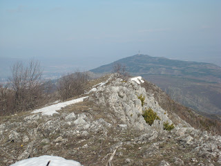
| The beginning of the ridge. You can notice the last of the thick shrub and bush on the left. |
 |
| Keep on following the ridge. |
This is the best part for me, no more obstacles, just pure pleasure, walking along that ridge.
It's a rip!
However you have to be careful though in some parts, as the slope can be pretty unforgiving if you mess up, just look where you put your feet when you're walking.
The weather was sublime, all the sun you could ask for, not too much wind considering where I was, and not too cold either. I did have to put my wind breaker on for a while, but took it off after lunch.
My plan was to have lunch at the summit. I was getting hungry at this point, my stomach was making disgraceful and gruesome sounds, but I couldn't really afford to stop because I was pressed for time. Daylight is preferable to darkness, so I kept on going.
 |
| Not far from the summit. |
 |
| View of the Treska canyon. |
 |
| More... |
I had contemplated not going all the way to the top because my time was running out (I always privilege safety first ), I didn't want to go back down using my headlamp, so I shifted my butt into first gear and made it on time.
 |
| Osoj summit, 1354m |
Yeah, you know I have to cook something good no matter where I go. And have a little drink to celebrate. Sometimes two...
I had forgotten my GPS on my backpack, so I had to go back and get it to measure the altitude.
Once done, I went back and had lunch, however I didn't waste too much time with that, as I still had to get back to civilization and I was pretty sure that I would have to go back the same way I came.
The long way.
In the end, that's exactly what happened, I never found an alternate route. Nothing, brother. Had to walk the same route back.
But that's not a problem.
Of course, it was all downhill so relatively easy.
From the summit to the mountain road, there is approximately 3 kilometres. Then another 8 to Gorna Matka village, and 2 more to Sv. Bogorodica.
You go from 293m to 1354m, an elevation gain of 1061m.
When my water was running low, I grabbed some snow and sucked on that for a while, kept me cool and hydrated. I drank more water then I expected too, I had taken 3.3 litres with me, but it was warmer then I had anticipated. I even caught a nice sunburn on my hands and face, the first of the year! When the sun comes out in Macedonia, it really hits down hard sometimes, so better to be protected. In particular if your up in the mountains.
In Gorna Matka, met some other people from the village who were just plain friendly, they offered me cigarettes and we chatted for a while. I love meeting people in this way, it's always interesting and you never know who you're going to meet.
At first, they wonder where the hell I'm from, then what am I doing here, and finally we talk and I'm often invited for coffee or tea, and some good smokes.
In this manner, I often gather a lot of interesting and valuable information and stories, and it gives a human touch to my otherwise (mostly) solitary expeditions.
So now I know what it's like at the top of the mountain that I can see from my house.
Would I go back there again?
Surely, but not the same way. The walk to Jasen reserve is a bit long. Not that it isn't interesting, just that once you've done it a couple of times, it's enough.
Better to spend some more time exploring at the summit. There is still much more to see.
If I eventually find an alternative route, I shall be thrilled let you know.
But for now, I have other places to explore. lots of other places!
 |
| GPS map of Osoj. |
Okay, to the next adventure....


No comments:
Post a Comment